
流域 Ryuiki
Overview
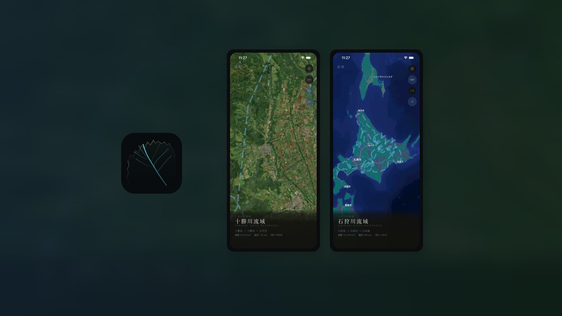
いま自分が立っている場所を、流域という視点から感じ直すiOSアプリ。地図を「場所を探すツール」ではなく、地球のエネルギー循環を知覚するインターフェースとして再定義する。
岸由二の流域思考と福岡伸一の動的平衡を思想的基盤に、足元の地形、水の流れ、山脈が形づくる境界を可視化。アプリを開くと現在地の地形が現れ、河川と流域の輪郭が浮かび上がり、自分がどの流域に属しているかを直感的に理解できる。北海道13一級水系、約26,000本の河川データに対応。
壮大な思想を、日常の小さな行為に接続する装置。
An iOS app that invites you to re-sense the place where you stand through the lens of watersheds. It redefines the map not as a tool for finding locations, but as an interface for perceiving the energy cycles of the earth.
Built on the philosophical foundations of Yuji Kishi's watershed thinking and Shin-ichi Fukuoka's dynamic equilibrium, the app visualizes the terrain beneath your feet, the flow of water, and the boundaries shaped by mountain ranges. Upon opening, the local terrain appears, rivers and watershed contours emerge, and you intuitively grasp which watershed you belong to. Covering all 13 primary river systems of Hokkaido with approximately 26,000 rivers.
A device that connects grand ideas to small, everyday acts.